


03-1 East Community Center Voting District, Hickman County, Tennessee
About
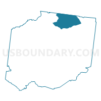
Outline

Summary
| Unique Area Identifier | 668870 |
| Name | 03-1 East Community Center Voting District |
| County | Hickman County |
| State | Tennessee |
| Area (square miles) | 30.44 |
| Land Area (square miles) | 30.44 |
| Water Area (square miles) | 0.00 |
| % of Land Area | 100.00 |
| % of Water Area | 0.00 |
| Latitude of the Internal Point | 35.94487550 |
| Longtitude of the Internal Point | -87.37743270 |
Maps


Graphs
Select a template below for downloading or customizing gragh for 03-1 East Community Center Voting District, Hickman County, Tennessee


Neighbors
Neighoring Voting District (by Name) Neighboring Voting District on the Map
- 01-3 Pinewood Voting District, Hickman County, TN
- 02-1 Pinewood Voting District, Hickman County, TN
- 02-3 East Bank Voting District, Hickman County, TN
- 04-1 Lake Benson Camp Voting District, Hickman County, TN
- 07-1 Pomona Baptist Church Voting District, Dickson County, TN
Top 10 Neighboring County Subdivision (by Population) Neighboring County Subdivision on the Map
- District 7, Dickson County, TN (4,353)
- District 4, Hickman County, TN (3,795)
- District 1, Hickman County, TN (3,793)
- District 3, Hickman County, TN (3,606)
- District 2, Hickman County, TN (3,509)
Top 10 Neighboring Place (by Population) Neighboring Place on the Map
Top 10 Neighboring Unified School District (by Population) Neighboring Unified School District on the Map
Top 10 Neighboring State Legislative District Lower Chamber (by Population) Neighboring State Legislative District Lower Chamber on the Map
Top 10 Neighboring State Legislative District Upper Chamber (by Population) Neighboring State Legislative District Upper Chamber on the Map
Top 10 Neighboring 111th Congressional District (by Population) Neighboring 111th Congressional District on the Map
- Congressional District 7, TN (792,605)
- Congressional District 4, TN (688,008)
- Congressional District 8, TN (658,258)
Top 10 Neighboring Census Tract (by Population) Neighboring Census Tract on the Map
- Census Tract 9502, Hickman County, TN (6,969)
- Census Tract 606.02, Dickson County, TN (6,538)
- Census Tract 9501, Hickman County, TN (5,528)